
On the shepherd's path
Mittel
10.2 km
4:15 h
450 Hm
611 Hm

Filip Zuan
7 Bilder anzeigen
Filip Zuan
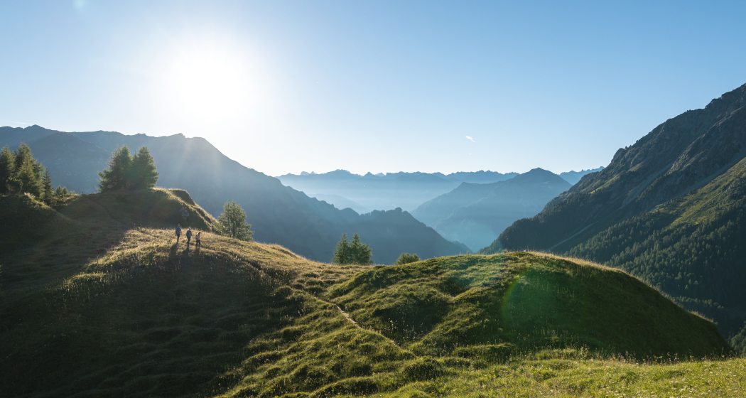
High above Samnaun, rugged peaks, sparkling streams and panoramas to distant mountains beckon - an alpine experience for sure-footed hikers with a sense of adventure.
Beste Jahreszeit
Jan
Feb
Mär
Apr
Mai
Jun
Jul
Aug
Sep
Okt
Nov
Dez
Start
Signpost at the Votlas parking lot on the road branching off next to Hotel Post in Samnaun
Ziel
Bus stop in Compatsch
Koordinaten
46.942569, 10.361994
Details
Beschreibung
The route leads from Samnaun Village along the slopes above the high valley of Samnaun to Compatsch, from where you can take the bus back. You hike at and above the tree line. Along the way, the steep flanks of Piz Motnairs with their debris flows and streams are crossed. There are magnificent deep views into the valley, on the villages, and views of the mountains beyond the valley. The protections at some points make this tour suitable for sure-footed and fearless mountain hikers and offer a great hiking experience far above the settlement.
Geheimtipp
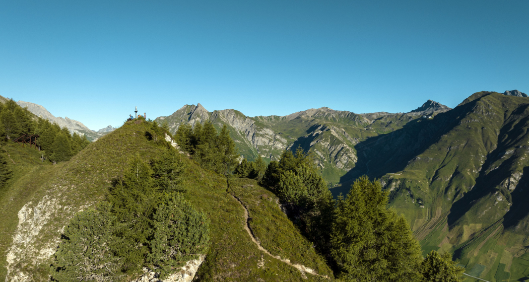
If you want, you can also take the summit of Piz Motnair with you. There and back on the same path, the view is magnificent!
Sicherheitshinweis
Steep passages require attention
Ausrüstung
Normal weather-appropriate hiking gear and provisions.
Wegbeschreibung
From the signboard at the Votlas parking lot to the Motta Saltuorn and Fuorcla Curschiglias (S) signposts on a forest road uphill, past the signs of a fairy tale path depicting the story of two marmots very appealingly. You cross a stream coming down from Val Motnaida, pass a slate outcrop, alpine roses, and arnica spots. Beyond the valley, you see Trider Sattel, Piz Ott, and Piz Munschuns. Then you reach the Motta Saltourn (1) fork, where you could already descend to Ravaisch, Plan, and Laret. Further uphill and after a hairpin turn to a hut with seating and fountain. Then you reach the end of the road, turn left, and climb steeper on a path. At the tree line, you reach a bench with a particularly beautiful view of Samnaun, into the Zeblas Valley towards Piz Ott, and walk past the massive Val Motnaida. Afterwards, you arrive at avalanche protections and cross Val Chiens below Piz Motnairs. Opposite the valley there is a panorama with numerous peaks. Then comes MottaFoppazins, a fork (2), from which you could already descend and continue the route on a path running lower on the slope. Further on the upper path past a small peak with a cross, located exactly south of Compatsch and therefore also called Mittagsspitze (noon peak). After a second cross, where there is again a magnificent view, you reach Fuorcla Curschiglias (3). At this fork, go left toward Laret and Motta Foppazins signposts. The direct descent to Compatsch is very steep and not recommended. Shortly thereafter, another fork follows where you continue in the direction of Compatsch Laret. At a hairpin with a fork, continue in the direction of Compatsch Laret. After a turnoff to the valley trail to Samnaun, you reach the Laret Compatsch fork. On the right, you reach the valley road at the Compatsch junction with bus stop (4).
Anfahrt
Öffentliche Verkehrsmittel
From the Lower Engadine by bus line 90.921 to Samnaun Village, Post
Arrival information
From the Lower Engadine on roads No. 27 and 184 via Vinadi or via Kajetansbrücke, from Austria and from the direction of Italy road No. 180 to Kajetansbrücke, then on a side road to the center of Samnaun Village. Here turn left onto Votlastraße to the Votlas parking lot above the town center.
Parken
Parking Votlas
Verantwortlich für diesen Inhalt Wandermagazin.
Dieser Inhalt wurde automatisiert übersetzt.
Diese Webseite nutzt Technologie und Inhalte der Outdooractive Plattform.